
Grayslake Previous Resident Sources
No single roll lists every person who occupied a Grayslake address. The strongest trail joins a dated parcel record with deeds, physical maps, and named local sources. Start with official land records, then test whether newspapers or archival files place a person at that site. This order keeps an owner name from being mistaken for a full household.
| Source | Period covered | Where kept | What it can show |
|---|---|---|---|
| Recorded deed index | 1980 to present online; 1841 to 1979 in historical index books | Lake County Recorder | Grantor, grantee, instrument, date, legal description |
| Parcel and tax records | Current card plus available sales and conveyance history | Lake County property portal | PIN, owner field, situs, mailing address, lot, sale fields |
| Maps, plats, and atlases | Includes an 1885 atlas and county historic map layers | County GIS and local collections | Parcel shape, subdivision, roads, and site context |
| Grays Lake Sanborn sheets | 1934, four verified sheets | UIUC and Library of Congress | Mapped building footprint, use, materials, and street labels |
| Local name sources | Dates vary; newspaper begins in 1905 | Historical Society, library, and digital archive | Dated notices, obituaries, family files, yearbooks, oral histories |
A present-day question should start with the assessor. A nineteenth-century question may start with deed books, plats, probate, or an atlas because a modern street number may not exist. For twentieth-century past residents, add telephone material and the Grayslake Times only after the land trail identifies the right place and date.
Anchor Grayslake Address Records
The Lake County Property Tax Basic Search is the clean first stop. Search by one primary mode only: Parcel ID, Owner, or Address Number plus Street. The address form separates direction, suffix, unit, city, and ZIP. Preserve the PIN, property location, mailing address, tax year, legal subdivision and lot, and any split or combine marker.
The portal's sample Grayslake card demonstrates why those fields matter. It exposes acres, square feet, class, use code, tax-code area, neighborhood label, active status, and separate location and mailing fields. Those are record fields, not proof that every named owner lived on the parcel. The visible year must also travel with the note because assessment, tax, and taxes-payable years can differ.
Note: A current PIN and legal description are safer historical anchors than a street address alone.
Trace Grayslake Owners Backward
A chain of title is the linked sequence of recorded transfers for the same land. Lake County separates its modern index from older books, so a blank modern search does not end the work. The Lake County Official Records Search accepts party names, dates, document type or number, parcel, township, property address, book and page, and legal-description terms.
- Copy the current PIN, owner field, and legal description from the parcel card.
- Find the latest purchase instrument. Record the deed type, grantor, grantee, sale or conveyance date, recording date, and instrument number.
- Search the grantor as a prior grantee. Match the legal description or PIN before accepting the result.
- Repeat the link. Mark any parcel split, combine, changed PIN, or branch involving more than one tract.
- For dates before 1980, move to Historical Record, Online Index Books, and Grantor-Grantee books or use the free public terminals.
- Grantor and grantee
- The grantor transfers an interest; the grantee receives it.
- Chain of title
- The documented line of transfers for one legal parcel.
- Legal description
- The formal land description used in deeds and plats, which can survive a street-name change.
The Recorder advanced search shows the historical and detailed search route used for Grayslake previous residents.
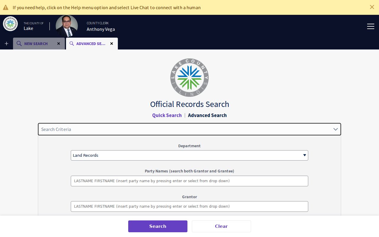
The captured screen helps identify the right fields before a current chain moves into Lake County's older index books.
Grayslake Deed Dates Differ
Sale, execution, conveyance, and recording dates can describe separate events. The tax sales view can show grantor, grantee, sale date, recording date, deed type, instrument number, price, and sale type. The conveyance view adds parties, preparer, tax-bill name, legal description, stamps, PTAX fields, and assessment values. Keep the portal's own label rather than calling every date the move-in date.
See how the sample parcel sales history separates transaction fields.
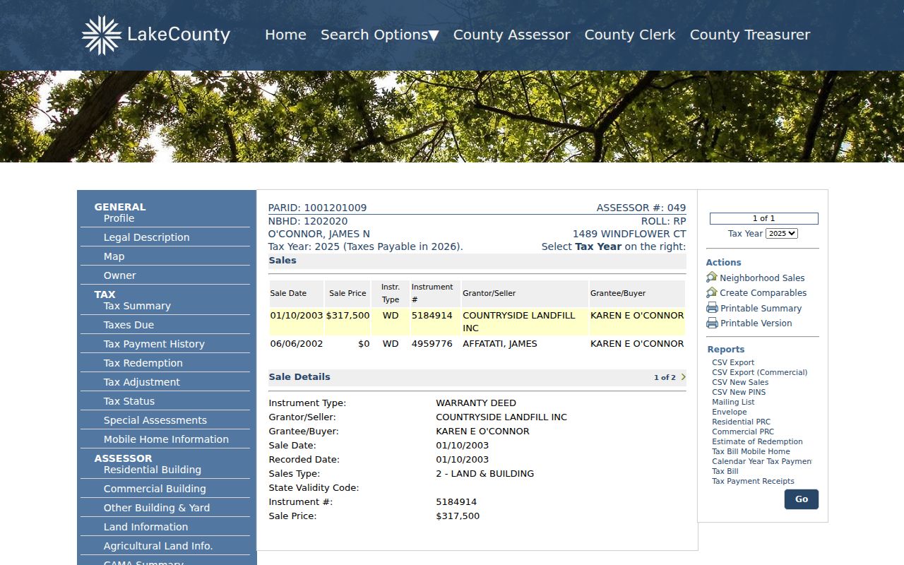
This view is useful for leads, but the Recorder remains the official source for the recorded instrument.
The matching sample conveyance detail reveals a different set of indexed facts.
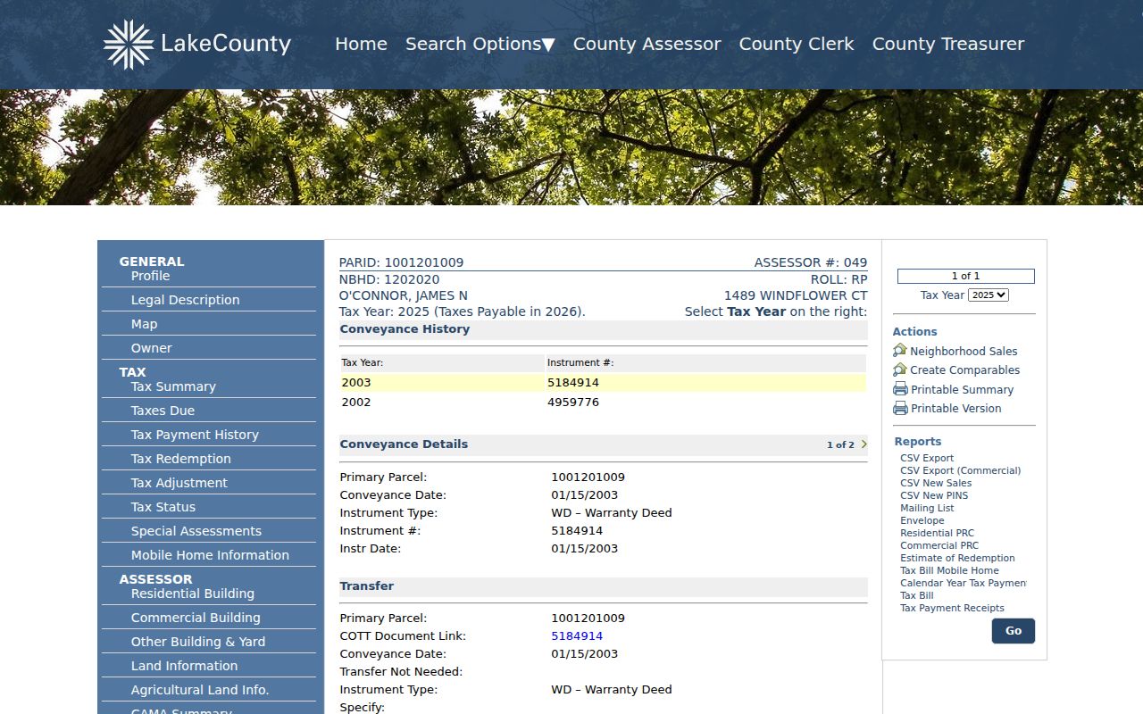
Together, the screens show why a sound address history cites the field name, source, and year instead of turning a transaction into an occupancy claim.
Map Past Grayslake Parcels
Use the Tax Parcel Viewer to compare today's tract with lots, subdivisions, condominiums, roads, rights of way, historic tax-map images, and address labels. The map is a reference, not a legal survey. If a PIN changed, follow the legal description and recorded split or consolidation instead of forcing two map shapes into one line.
Regional house-history research also points to the 1885 atlas, aerials, street guides, and plats. The Grayslake Historical Society lists maps, plats, and abstracts of title among its collections, but it does not promise an online abstract for each house. Ask for the exact item and label an abstract as an archival lead until it is inspected.
Four Grayslake Sanborn Sheets
The only verified local Sanborn set is the 1934 Grays Lake group of four sheets. These fire-insurance maps can place a footprint, building material, use, and street label on a dated block. They do not list all previous residents. A site missing from one sheet may lie outside the small mapped area, so check deeds, plats, aerials, newspapers, and tax records before drawing a conclusion.
This is an important Grayslake quirk. Record the sheet number and visible labels. The map's spelling may also differ from the current village name.
Map rule. Treat the 1934 footprint as building evidence, never as proof that a named person occupied it.
Older Grayslake Address Forms
House numbers began in the region during the 1920s, and farms or rural homes often had none. Grayslake history also identifies Center Avenue as today's Lake Street. Search both forms, along with Gray's Lake, Grays Lake, and Grayslake, in old maps and newspapers. The 1918 paving reference can help separate a historic Center Avenue result from a later Lake Street entry.
The railroad station, village plat, and post office arrived in 1886. For earlier or lightly numbered records, use a route, lot, landmark, business, depot, or nearby owner as a finding aid. Do not invent a modern number for an older description.
Note: No official broad Grayslake street-renumbering project was found, so test documented variants one at a time.
Grayslake Past Household Evidence
Owners are only one layer. To identify who lived here before, pair deed dates with dated telephone material, census records, newspaper notices, obituaries, yearbooks, oral histories, and family files. The Historical Society's archive includes the Grayslake Times, title abstracts, family collections, and oral histories. The full collection context belongs on the Grayslake city directories page.
- Fix the parcel and street form for the target year.
- Check the closest available telephone or directory year for the address.
- Compare the next public census year, while allowing for rural routes and changed numbers.
- Confirm a name with a dated newspaper, obituary, yearbook, vital index, or family-file item.
The Grayslake Times began in 1905, yet whole runs and individual issues are missing. A blank search during a gap is not evidence that a family was absent. The Society obituary file offers a 1905 to 1940 death-notice index and an obituary file from 1980 onward, with its own gaps and research terms.
Review the Historical Society obituary index as one dated endpoint for previous residents.
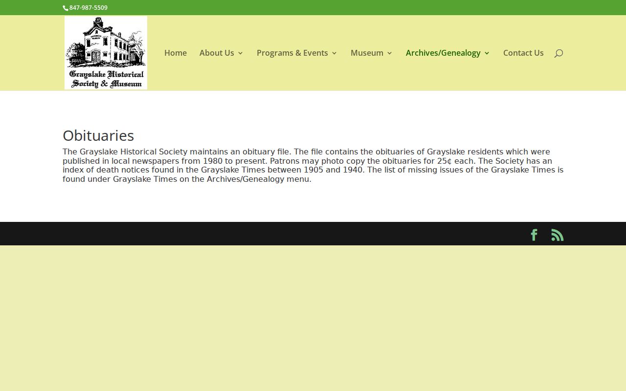
The index can connect a person to local death notices, but the cited issue or copy must still be checked against the address trail.
Limits of Grayslake Resident Trails
A full chain may stop at an unindexed book, missing newspaper, restricted vital record, parcel split, changed street, or collection that requires an appointment. One deed can cover several parcels. A building can remain while its legal lot changes. An owner may receive mail outside Grayslake. Preserve each branch rather than forcing a neat list of past residents.
State the last item actually found and list the sources searched. Additional predecessor records may remain in historical books, archival files, missing issues, or restricted collections. That honest cutoff is more useful than a likely but unsupported name.
Lawful use. Research previous residents for family or house history. Never use a record trail to track, harass, or harm a living person.