
Walk a Grayslake Street
A reliable street-by-street search uses several dated records instead of treating one result as a household roster. Start with the modern property location. Then carry the parcel identification number, or PIN, into map and recorded-document systems. Add historical material only after the present street form is clear.
- Enter the street number and street name in the Lake County property search. Use address as the sole primary search mode.
- Open the parcel profile and record the PIN, situs address, mailing address, tax year, subdivision, lot, and property class.
- View that PIN and nearby parcels in the county map. Note the selected layers and map date.
- Search the Recorder's Official Records Search by parcel, address, party, or legal description, moving backward by recorded instrument.
- For an older street directory trail, check maps, newspapers, telephone books, and Society collections under every known street and place-name form.
This chain answers different parts of one question. The assessor shows a dated ownership and assessment record. GIS places the parcel. Recorded instruments document transfers or claims. Historical sources can show names or uses at a point in time.
Search Grayslake Address Fields
The assessor interface gives unusually exact controls. Its key instruction is easy to miss: use only one of Parcel ID, Owner, or Address No plus Street. Filling more than one primary route can prevent a useful match. For a by-address search, omit the direction from the street-name box because direction has its own menu.
| Field | Use | Limit |
|---|---|---|
| Address No + Street | Primary street route | Do not combine with owner or PIN |
| Direction | E, N, NE, NW, S, SE, SW, or W | Separate from street text |
| Suffix / Suffix 2 | Test the current road type | Old sources may omit it |
| Unit | Narrow a multi-unit address | A parent parcel may cover many units |
| City / ZIP | Select GRAYSLAKE or a postal value | Neither proves village limits |
The owner field expects last name, first name and assumes a wildcard at the end; an asterisk may also be inserted. Township choices include Avon and Fremont, but township lines are not the same as Grayslake boundaries.
Search tip. If the exact address fails, test its suffix and direction as separate controls before changing the street name.
Read a Grayslake Parcel Card
A parcel card separates a property location, often called the situs address, from the address where the tax bill is mailed. That difference may reflect an owner who receives mail elsewhere, but it does not establish occupancy. Illinois also uses a two-year property-tax cycle, so the assessment year, tax year, and taxes-payable year must stay attached to the values they describe.
The inspected Grayslake sample shows PIN, assessor jurisdiction, neighborhood, owner, mailing address, property location, class and use, acres, square feet, subdivision, legal lot, tax-code area, and split or combine indicators. The official sample parcel profile shows that layout.
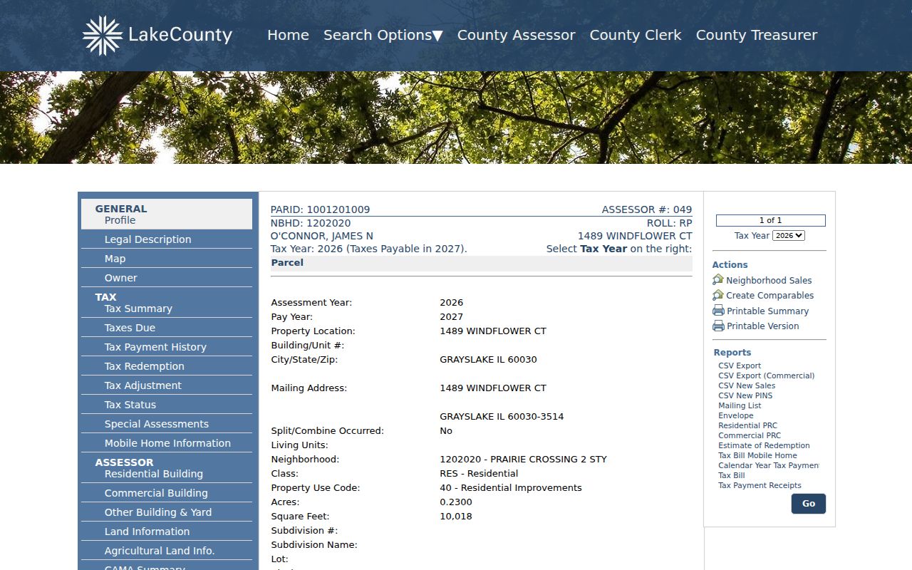
The image shows why a street result needs its tax year and field labels, rather than a broad claim about who lives there. Lake County also bars scraping and unauthorized extraction.
Map Grayslake Streets and Lots
The Tax Parcel Viewer connects address text to mapped land. Search by PIN, address, or place, then inspect Tax Parcels, address labels, road centerlines, subdivisions, condominiums, lots, historic tax images, and right-of-way layers. A map selection can return several parcels, so save the scale, selected layer, and date if the result will be compared later.
The Lake County GIS and Mapping page explains county addressing, parcel splits, consolidations, districts, and map access.
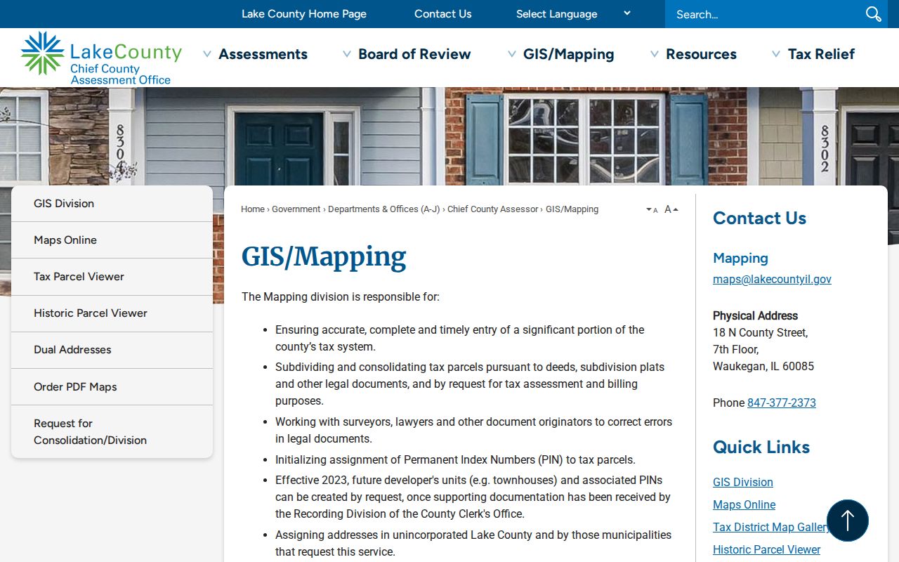
This source explains why a new address point or PIN may update after the recorded subdivision document and why Village confirmation may still be needed.
The county also publishes its GIS maps and open-data landing page.
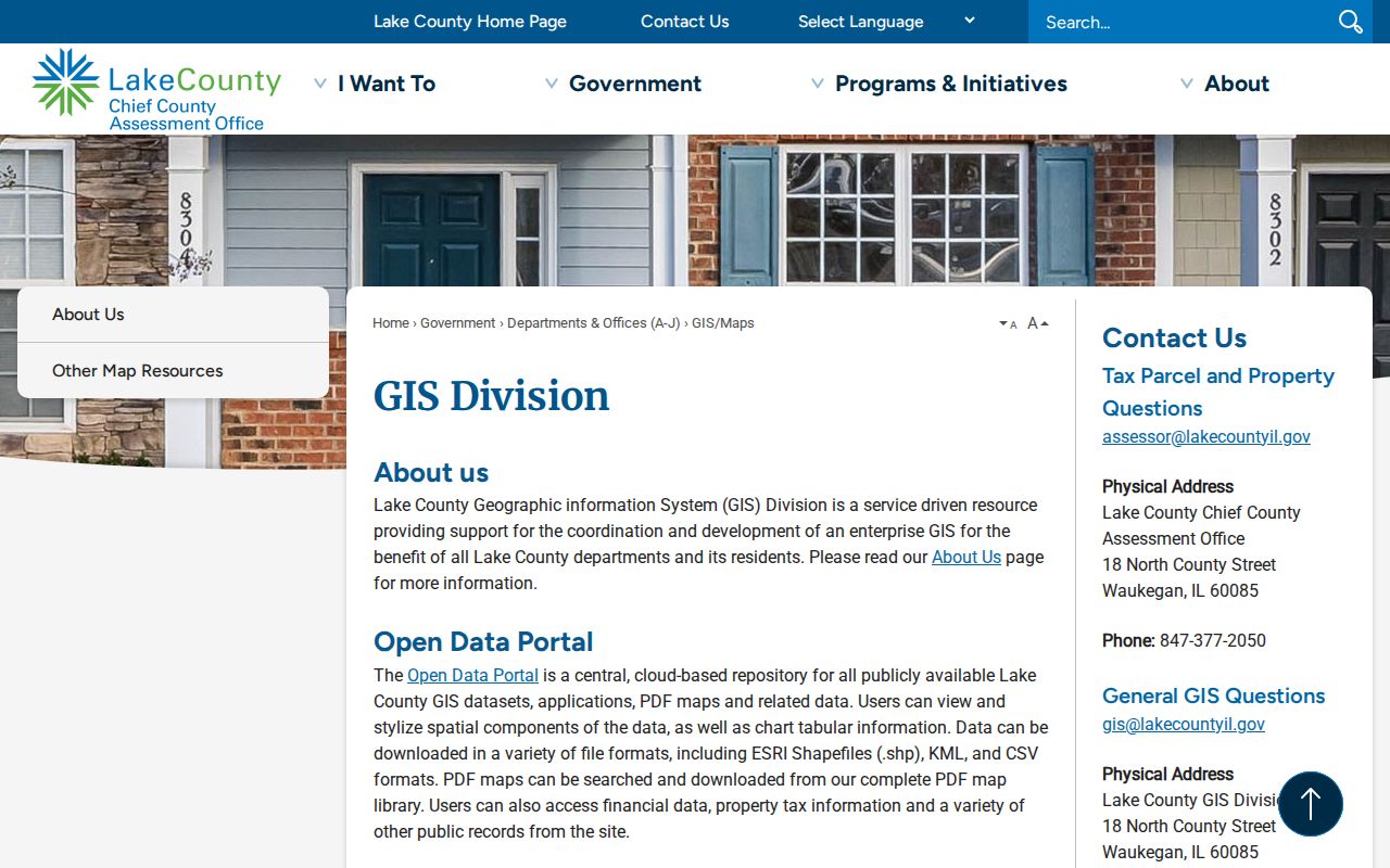
Its catalog provides the context needed to distinguish parcels, roads, address points, ZIP areas, and municipal boundaries. These maps are references, not surveys.
Grayslake Records by Street
No official source supplies a complete list of everyone on a Grayslake street. Useful records are event-based or parcel-based, and each has its own custodian and access route.
| Record | Keeper | Result | Access |
|---|---|---|---|
| Assessment profile | County assessor | Dated owner, PIN, situs, class | Free portal |
| Parcel map | County GIS | Lots, roads, labels, boundaries | Viewer, open data, staff |
| Deeds and plats | Recorder | Parties, instruments, dates, legal text | Web, books, terminal, copies |
| Permit file | Village | Address, project, owner or contractor fields | Targeted FOIA |
| Historic street evidence | Society and libraries | Maps, newspapers, directories, abstracts | Digital, microfilm, staff request |
A useful street directory worksheet keeps one row per source event. Never merge a current tax owner, a deed, a 1934 building footprint, and a newspaper mention into one supposed resident record.
Trace Grayslake Street Deeds
The Recorder's current index covers 1980 forward. Quick Search accepts a party, subdivision, document type or number, and recorded-date range. Advanced controls add party role, book and page, parcel, township, property address, remarks, and legal description. A grantor transfers an interest; a grantee receives it. Neither term says who occupied the property.
For older instruments, use Historical Record, Online Index Books, and Grantor-Grantee books. The Recorder search pamphlet documents the split and in-person fallback. Public terminals on the sixth floor in Waukegan are free to search weekdays from 8:30 a.m. to 5 p.m. Copies are $1 per page, while online subscriptions begin at $5.
- Parcel or PIN
- The county identification number assigned to a tract.
- Situs address
- The physical property location, which may differ from a mailing address.
- Plat
- A recorded map of lots, roads, or a subdivision.
- Criss-cross directory
- A volume arranged by address or street rather than surname.
The Recorder can help locate public records but does not guarantee a full title search. Keep conveyance, execution, recording, and tax dates under their official labels.
Request Grayslake Permit Records
No public Village permit-by-address index was located. The request channel is therefore the lead. The building permit form shows likely fields in a responsive file, including property location, owner or lessee, contractor, design professional, project type, occupancy or use, fees, approvals, and certificate-of-occupancy details.
The Village planning and zoning resources connect zoning maps, applications, ordinances, and planning material.
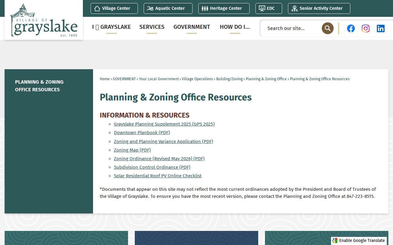
The screenshot places address research in the correct municipal department instead of the county parcel system.
Use the Village FOIA route for a defined permit or inspection record. Give the address, date span, permit number if known, and record type. The form supports inspection, copying, or certification.
Search Grayslake Street Names
Grayslake history creates address traps. Center Avenue is now Lake Street, and the Society chronology ties the older form to paving in 1918. Early sources may spell the place Gray's Lake or Grays Lake. House numbers began in the 1920s, while rural homes and farms could be identified by route, lot, owner, subdivision, or landmark.
Search both street forms in the Historical Society chronology, deeds, maps, and newspapers. Proctor's subdivision dates to 1903. Oakland was developed in 1913 along Hillside, Prairie View, First, and Second streets, and the Village History Trail records the local name Klingerville. Treat that nickname as historical usage, not a legal subdivision.
Note: No official local street-renumbering project was found, so do not infer a mass number change from a failed search.
Compare Grayslake's 1934 Blocks
The only verified local Sanborn fire-insurance set is Grays Lake, 1934, four sheets. These maps can show a footprint, construction material, use, street label, and block arrangement. They do not identify every person in a structure.
Open the Library of Congress Grays Lake sheets and record the sheet number, date, visible street form, and building symbol. Compare that view with the current parcel and lot layers. The result may show that a building or street configuration existed at two dates, while leaving occupancy as a separate question.
Fill Grayslake Address Gaps
The Historical Society's Grayslake Times holdings cover a weekly paper begun in 1905, but whole runs are missing for 1914–1915, 1927, 1929, 1946, 1998, and 2010–2011. Search by street, institution, event, or surname. Note whether the hit is print, microfilm, a digital facsimile, or an index.
Telephone books are incomplete too. Regional guides identify 1904–1959 material online and later print runs, but no full Grayslake-specific criss-cross series was found. The historical volumes and substitutes appear on the Grayslake city directory page. Society maps, plats, title abstracts, family files, and oral histories provide fallbacks when the web has no match.
Grayslake Street Directory Limits
A parcel owner is not automatically a resident. A mailing address does not prove physical location, a deed records an interest rather than a household, and a Sanborn map shows a building rather than its occupants. County ZIP, assessor City Name, GIS address point, USPS label, and Village boundary answer different geographic questions.
The voter file is not a public street roster. Lake County limits electronic file access to eligible political or government purposes, applies statutory redactions, and does not register voters by party. Utility customer data and motor-vehicle addresses are not open household lists. Confidentiality measures may also suppress an address where law allows.
Lawful use. Use Grayslake address records for legitimate personal research, and never use them to stalk, harass, intimidate, or harm anyone.
A careful street directory result states the source, source date, record date, field used, and limit. That is more useful than an unsupported claim about who lives behind a door.